Project Overview
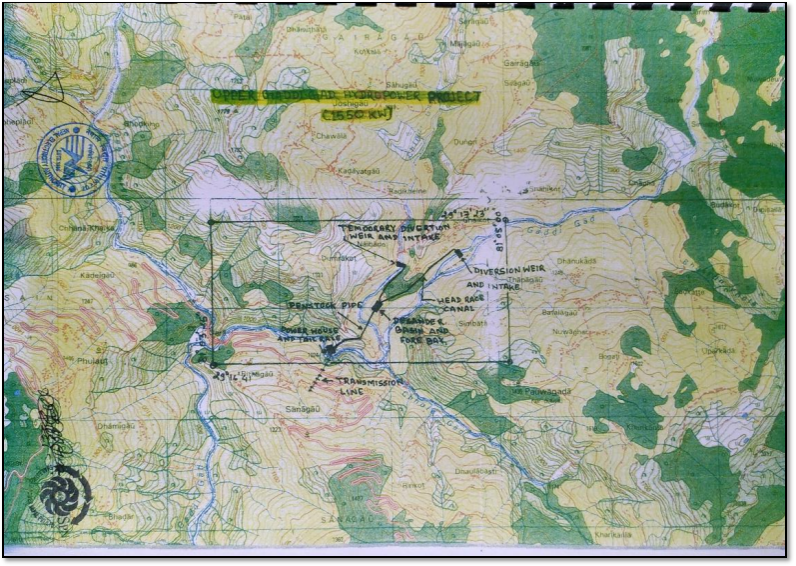
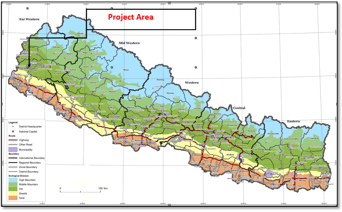
The Mathilo Gaddigad Hydropower Project is a run-of-the-river (ROR) type hydropower project, located in Purbichauki Gaunpalika, Doti District of Province No. 7, Nepal. Here is a brief information on the project.
Overview
- Type: Run of the River (ROR) hydropower project
- Location: Purbichauki Rural Municipality, Doti District, Province No. 7, Nepal
- Installed Capacity: 1,550 kW
- Annual Energy Generation: 8.42 GWh
Geographic Information
- Coordinates:
- Weir Site: 29° 16’ 41” N, 81° 03’ 25” E
- Powerhouse Site: 29° 17’ 30” N, 81° 06’ 30”
- Elevation: 926.95 m (Powerhouse)
- Nearby Locations: 2.5 km upstream from Sanjighat, 45 km northeast of Dipayal, 30 km from Silgadhi
| S.N. | Distance From | To | Distance (Km) | Route |
|---|---|---|---|---|
| 1 | Shankhamul, Kathmandu | Attariya, Kailali | 648.0 | Prithivi / Mahendra Highway |
| 2 | Attariya | Dipayal Silgadhi | 202.0 | Mahakali / Mid-Hill Highway |
| 3 | Dipayal Silgadhi | Sanjighat | 25.0 | Mid-Hill Highway |
| 4 | Sanjighat | Powerhouse | 0.5 | Mid-Hill Highway |
| 5 | Powerhouse | Intake | 2.0 | Earthen Road |
| Total Road Length From KTM to Intake | 877.5 | |||
Hydrological Features
- River: Gaddigad, a tributary of the Seti River, flowing into the Karnali
- Design Discharge: 2.01 m³/s (40% dependable flow)
- Gross Head: 102.5 m over alignment stretch of approx 2.0 km
Infrastructure Details
- Weir Location: Right bank of Gaddigad, 200 m upstream of suspension bridge
- Powerhouse Location: Left bank near Sanjighat Bazar
- Pipeline:
- Low pressure pipe through forest and cultivated land
- High-pressure penstock beyond surge pipe
- Mostly buried with crossings at valleys & rivers
- Tailrace Canal: Approx. 16 m discharge back into Gaddigad